Aguacaliente (Cartago)
Aguacaliente

| Pays | |
|---|---|
| Province | |
| Canton | |
| Superficie |
99,26 km2 |
| Altitude |
1 330 m |
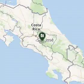
| Coordonnées |
9° 43′ 50″ N, 83° 51′ 35″ O |
| Population |
32 351 hab. () |
|---|---|
| Densité |
325,9 hab./km2 () |
| Statut |
|---|
| Code postal |
30105 |
|---|
Aguacaliente, également appelé San Francisco, est un district du Costa Rica faisant partie du canton de Cartago, dans la province du même nom.
Notes et références
 Portail du Costa Rica