Amphoe Ban Kruat
Ban Kruat

| Nom officiel |
(th) อำเภอบ้านกรวด |
|---|---|
| Nom local |
(th) อำเภอบ้านกรวด |
| Pays | |
|---|---|
| Province | |
| Superficie |
583,9 km2 |
| Altitude |
212 m |
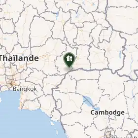
| Coordonnées |
14° 25′ 18″ N, 103° 06′ 00″ E |

| Population |
76 052 hab. () |
|---|---|
| Densité |
130,2 hab./km2 () |
| Statut |
|---|
| Origine du nom |
Ban Kruat (d) |
|---|
| Devise |
|---|
| Code postal |
31180 |
|---|
Amphoe Ban Kruat (thaï : บ้านกรวด) est un amphoe de la province de Buriram.
Histoire
Géographie
Démographie
Points d'intérêt
Références
Liens externes
 Portail de la Thaïlande