Fowlerville (Michigan)
Fowlerville
| Pays | |
|---|---|
| État | |
| Comté | |
| Baigné par |
Red Cedar River (en) |
| Superficie |
6,17 km2 () |
| Surface en eau |
1,53 % |
| Altitude |
275 m |
| Coordonnées |
42° 39′ 38″ N, 84° 04′ 23″ O |

| Population |
2 951 hab. () |
|---|---|
| Densité |
478,3 hab./km2 () |
| Statut |
|---|
| Fondation |
|---|
| Code postal |
48836 |
|---|---|
| Code FIPS |
26-30060 |
| GNIS |

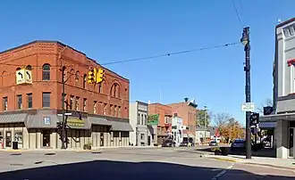
Fowlerville est un village du comté de Livingston, dans l'État du Michigan, aux États-Unis. En 2020, il comptait une population de 2 951 habitants.
Notes et références
- (en) Cet article est partiellement ou en totalité issu de l’article de Wikipédia en anglais intitulé « Fowlerville, Michigan » (voir la liste des auteurs).
Voir aussi
Articles connexes
Liens externes
- Ressource relative à la géographie :
- Ressource relative à la musique :
 Portail du Michigan