Mabini (Pangasinan)
Mabini
| Nom officiel |
(en) Municipality of Mabini |
|---|
| Pays | |
|---|---|
| Région | |
| Province | |
| Superficie |
291,01 km2 |
| Altitude |
51 m |
| Coordonnées |
16° 04′ 11″ N, 119° 56′ 24″ E |

| Population |
26 454 hab. () |
|---|---|
| Densité |
90,9 hab./km2 () |
| Statut | |
|---|---|
| Dépenses |
139,7 M₱ () |
| Revenu fiscal |
214,1 M₱ () |
| Code postal |
2409 |
|---|---|
| Indicatif téléphonique |
75 |
| Site web |
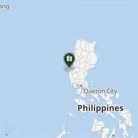
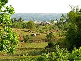
Mabini est une municipalité des Philippines située dans l'ouest de l'île de Luçon, dans la province de Pangasinan.
Subdivisions
Mabini est divisée en 16 barangays :
- Bacnit
- Barlo
- Caabiangaan
- Cabanaetan
- Cabinuangan
- Calzada
- Caranglaan
- De Guzman
- Luna (auparavant appelé Balayang[1])
- Magalong
- Nibaliw
- Patar
- Poblacion
- San Pedro
- Tagudin
- Villacorta
Notes et références
- ↑ (en) « An Act to Change the Name of Barrio Balayang, Mabini, Pangasinan, to Barrio Luna », LawPH.com (consulté le )
 Portail des Philippines