Powhatan (Arkansas)
Powhatan

| Pays | |
|---|---|
| État | |
| Comté | |
| Superficie |
0,64 km2 () |
| Surface en eau |
0 % |
| Altitude |
87 m |
| Coordonnées |
36° 04′ 59″ N, 91° 07′ 11″ O |

| Population |
104 hab. () |
|---|---|
| Densité |
162,5 hab./km2 () |
| Statut |
|---|
| Fondation |
|---|
| Code postal |
72458 |
|---|---|
| Code FIPS |
05-57050 |
| GNIS | |
| Indicatif téléphonique |
870 |
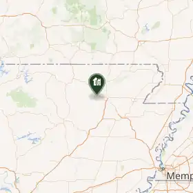
Powhatan est une ville située dans le comté de Lawrence, dans l’État de l’Arkansas, aux États-Unis. Sa population s’élevait à 72 habitants lors du recensement de 2010, estimée à 69 habitants en 2016.
Démographie
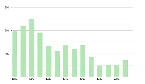
| Historique des recensements | |||
| Année | Pop. | %± | |
|---|---|---|---|
| 1880 | 196 | — | |
| 1890 | 220 | ▲ +12,24 % | |
| 1900 | 249 | ▲ +13,18 % | |
| 1910 | 191 | ▼ −23,29 % | |
| 1920 | 134 | ▼ −29,84 % | |
| 1930 | 110 | ▼ −17,91 % | |
| 1940 | 137 | ▲ +24,55 % | |
| 1950 | 120 | ▼ −12,41 % | |
| 1960 | 136 | ▲ +13,33 % | |
| 1970 | 84 | ▼ −38,24 % | |
| 1980 | 49 | ▼ −41,67 % | |
| 1990 | 51 | ▲ +4,08 % | |
| 2000 | 50 | ▼ −1,96 % | |
| 2010 | 72 | ▲ +44 % | |
Source
- (en) Cet article est partiellement ou en totalité issu de l’article de Wikipédia en anglais intitulé « Powhatan, Arkansas » (voir la liste des auteurs).
- ↑ « Statistiques des États-Unis - Arkansas - Profils des communautés de 2010 » (consulté en )
Liens externes
- Ressource relative à la géographie :
 Portail de l’Arkansas