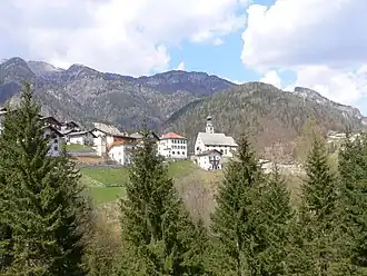
San Tomaso Agordino
| San Tomaso Agordino | |
| |
 Armoiries |
|
| Noms | |
|---|---|
| Nom ladin | San Tomas |
| Administration | |
| Pays | |
| Région | |
| Province | Belluno |
| Code postal | 32020 |
| Code ISTAT | 025049 |
| Code cadastral | I347 |
| Préfixe tel. | 0437 |
| Démographie | |
| Gentilé | santomasini |
| Population | 626 hab. (31-10-2020[1]) |
| Densité | 33 hab./km2 |
| Géographie | |
| Coordonnées | 46° 23′ 00″ nord, 11° 59′ 00″ est |
| Altitude | Min. 1 081 m Max. 1 081 m |
| Superficie | 1 900 ha = 19 km2 |
| Divers | |
| Fête patronale | Premier dimanche de septembre |
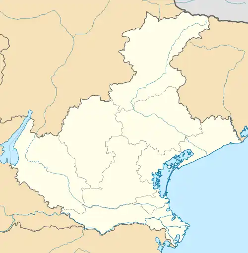
| Localisation | |
.svg.png) Localisation dans la province de Belluno. | |
| Liens | |
| Site web | Site officiel |
San Tomaso Agordino (ladin : San Tomas) est une commune de la province de Belluno dans la Vénétie en Italie.
Culture
La commune appartient à la communauté ladine et elle maintient sa culture et ses traditions ladines. Une influence du Tyrol se fait aussi remarquer, car la commune n'est pas loin de la frontière tyrolienne et a appartenu une époque à l'Autriche.
Administration
Celat, Chiea, Tocol, Colzaresè, Fontanelle, Roi, Colarù, La Costa, Avoscan, Sot Colarù, Vare, Forchiade, Piaia, Pecol, Pian Molin, Costa di Mezzo, Val, Mezzavalle, Vallata, Pianezze, Val di Zat, Ronch, Canacede, Costoia, L’Ancona.
Communes limitrophes
Alleghe, Cencenighe Agordino, Rocca Pietore, Taibon Agordino, Vallada Agordina
Notes et références
- ↑ (it) Popolazione residente e bilancio demografico sur le site de l'ISTAT.
 Portail de la Vénétie