Southam
Southam

| Pays | |
|---|---|
| Nation constitutive | |
| Région | |
| Comté non métropolitain | |
| District non métropolitain | |
| Superficie |
12,62 km2 () |
| Coordonnées |
52° 15′ 07″ N, 1° 23′ 24″ O |
| Population |
8 111 hab. () |
|---|---|
| Densité |
642,7 hab./km2 () |
| Statut |
|---|
| Code postal |
CV47 |
|---|---|
| Indicatif téléphonique |
01926 |
Prononciation
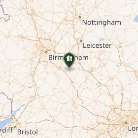
Southam est une ville du district de Stratford-on-Avon dans le Warwickshire, en Angleterre.
Elle a accueilli un concile, en 787, quand la ville s’appelait encore Calchut[1].
Notes et références
- ↑ CORDIER Pierre, « Remarques sur les inscriptions corporelles dans le monde romain: du signe d'identification (notitia) à la marque d'identité (identitas) », Pallas, , p. 189-198
Liens externes
- Ressource relative à la géographie :
- Ressource relative à la musique :
 Portail de l’Angleterre