Szentkatalin
| Szentkatalin | |||

| |||
|
|||
| Administration | |||
|---|---|---|---|
| Pays | |||
| Comitat (vármegye) |
(Transdanubie méridionale) |
||
| District (járás) |
Szentlőrinc | ||
| Rang | Commune | ||
| Bourgmestre (polgármester) Mandat |
Dóra József (indépendant) (2014-2019) |
||
| Code postal | 7681 | ||
| Indicatif téléphonique | (+36) 73 | ||
| Démographie | |||
| Population | 93 hab. () | ||
| Densité | 7 hab./km2 | ||
| Géographie | |||
| Coordonnées | 46° 10′ 41″ nord, 18° 03′ 10″ est | ||
| Superficie | 1 331 ha = 13,31 km2 | ||
| Divers | |||
| Identités ethniques (nemzetiségi kötődés) |
Hongrois 99,3 %, Tsiganes 2,2 % (2001) | ||
| Religions | catholiques 74,5 %, réformés 10,2 %, sans religion 11,7 % (2001) | ||
| Liens | |||
| Site web | www.szentkatalin.hu | ||
| Sources | |||
| Office central de statistiques (KSH) | |||
| Élections municipales 2014 | |||

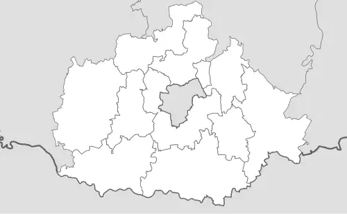
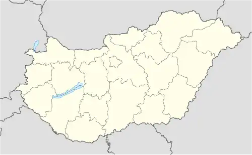
Szentkatalin est un village et une commune du comitat de Baranya en Hongrie.
Géographie
Histoire
Économie
Transports en commun
Personnages célèbres
Enseignement
Édifices et lieux d'intérêt
Villes jumelées
Références
 Portail de la Hongrie